TI Coastal Services, Inc.
Leaders in Quality Engineering and Surveying
About the firm
TI Coastal Services is a coastal engineering and surveying firm based in Wilmington, North Carolina, founded in 2013. Specializing in coastal engineering, professional land surveying, near-shore hydrographic surveying, and coastal geology and geomorphology, TI Coastal serves the dredging, coastal, and beach communities along the East Coast. The team brings over 50 years of combined experience and more than 100 coastal construction projects, staffed by licensed Professional Engineers, Professional Geologists, and Professional Land Surveyors. A USACE-certified sediment analysis laboratory and AASHTO certification support the geotechnical and sediment analysis practice. Clients include coastal municipalities such as Figure 8 Island, Oak Island, and Topsail Beach, North Carolina.
- Established
- 2013
- Firm type
- Coastal Engineering · Land Surveying
Credentials
USACE-certified sediment analysis laboratory · AASHTO certification
Capabilities
Beach Monitoring
Annual coastline and channel surveys for coastal communities to monitor beach health and quantify volumetric changes through sediment accretion and erosion. Programs support FEMA Engineered Beach accreditation and deliver vibracore sand-searching analysis, QCM and SSHO services, storm histories, and preparation recommendations.
Hydrographic Surveys
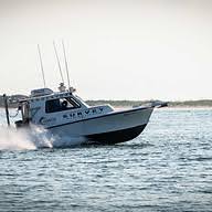
Near-shore and inland water surveys producing digital terrain models, bathymetric maps, contour maps, and isopach maps. Vessel fleet ranges from 16 to 28 feet for flexibility across project size, depth, and weather conditions.
- Single-Beam Bathymetric Surveys
- Multi-Beam Bathymetric Surveys
- Dual-Frequency Surveys
Marina Surveys
Hydrographic and land survey of marina conditions and sub-bottom terrain, with results and recommendations for dredging and engineering. Includes sediment sampling for heavy metals and pollutants.
Topographic Surveys
Stand-alone or integrated topographic surveys supporting engineering, dredging, and monitoring projects, using modern technology and traditional methods matched to each task.
Sidescan Sonar
Seafloor imaging with a towed sonar fish for archaeological investigations, dredge pipeline tracking, steel debris identification, and location of lost anchors and dredge cutter heads.
Lidar Surveys
High-resolution above-water surface surveys using the latest LIDAR technology.
Drone Surveys
Beach and waterway condition photography and inspection using an Evo II Pro drone with auto collision avoidance, autonomous navigation, and ultra-HD 6K camera.
Geotechnical Analysis
Sediment analysis and geotechnical assessment through a USACE-certified laboratory with AASHTO certification.
Magnetometer Surveys
Magnetometer tow-fish surveys for archaeological investigations, dredge pipeline tracking, steel debris, and lost marine objects.
Disposal Island Surveys
Survey, modeling, and analysis of disposal islands along the East Coast barrier islands and the Atlantic Intracoastal Waterway.
Dredge Surveys
Precision survey support for large and small dredge companies throughout the full dredge project lifecycle.
Lakes, Rivers & Dams
Freshwater body surveys for lakes, rivers, and dams using the same hydrographic equipment applied to coastal projects.
Permitting & Certifications
Regulatory permitting support from a team of licensed Professional Engineers, Professional Geologists, and Professional Land Surveyors.
Industries
Marine · Water Resources · Government
Projects
No projects listed yet.